
Where are these systems located, and what kinds of communication are they?While on site I drew a quick overview sketch of the estate and annotated it as I walked, so it records the order in which I noticed things as well as their positions.
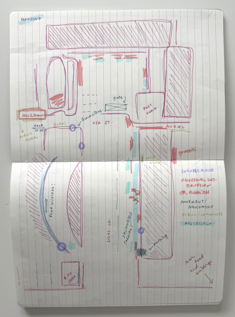
Back home I sorted my photographs into five categories, keeping the categories few so the patterns stayed visible:
- Restrict: things that say no, such as no entry, access forbidden, no fly tipping
- Control: rules about behaviour, such as keep bin locked, dog litter, designated cycle parking
- Surveil: CCTV, warning signs, Safer Neighbourhoods notices
- Navigate: block numbers, entrances, door entry, gates
- Disrupt: graffiti, stickers, damaged and blacked-out signs, misplaced rubbish
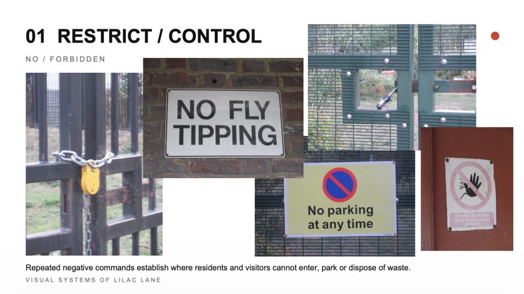
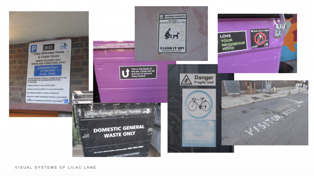
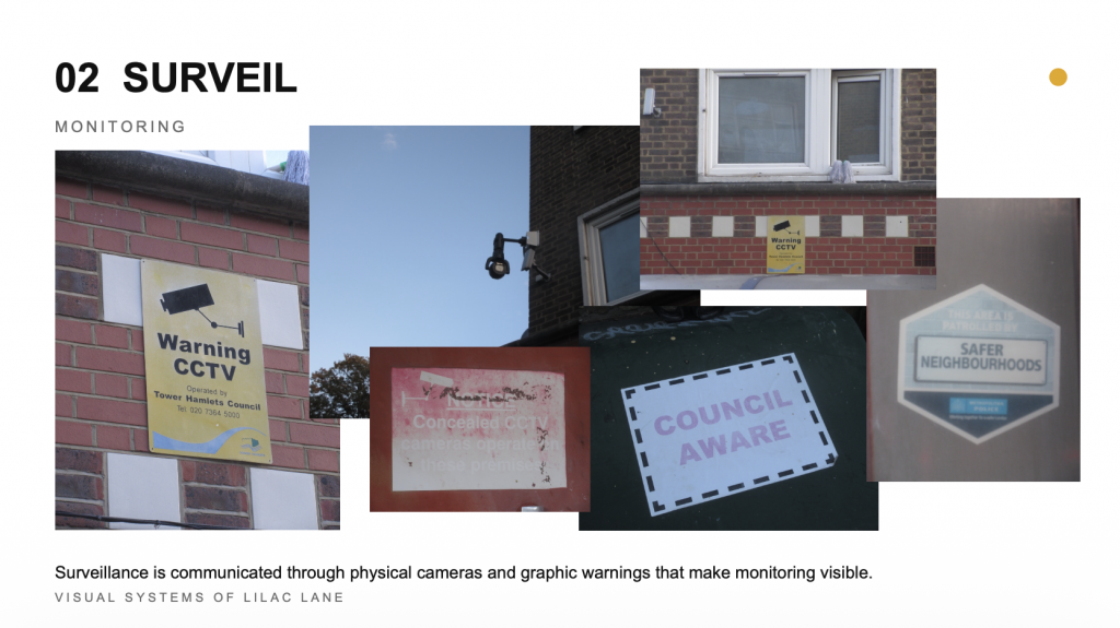
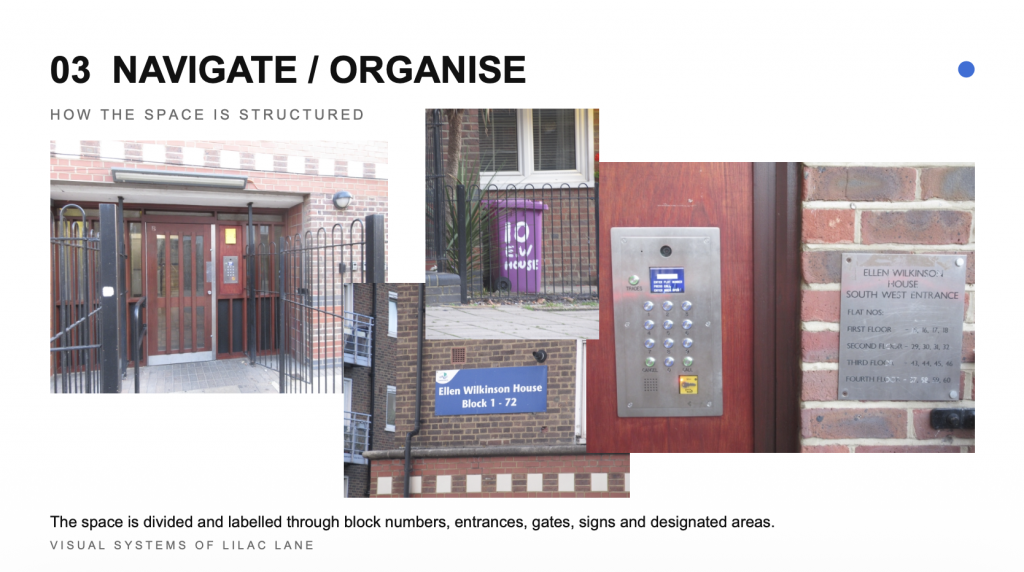
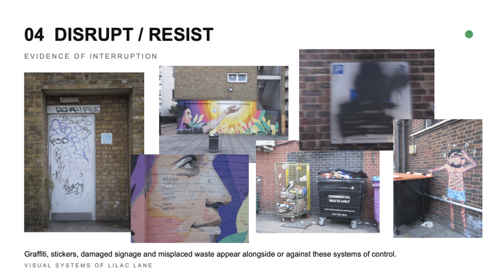
Sorting made it clear that the estate is divided, labelled and monitored at the same time, and that graphic design is part of that: signs, logos and numbering systems do as much work as the physical barriers. I began calling this “architectural confinement”, but I want to be careful with that phrase. I do not mean literal imprisonment. I mean the way a built environment sets boundaries, permissions and restrictions through physical and graphic systems together.
The fifth category matters most to me. It shows the designed estate (instructions) next to the used estate (what people actually do), which turns a catalogue of signs into a pattern of system and response.
I also noticed a mural on the estate with graffiti on top of it. I return to this in post 05.
If I redraw the sketch accurately and separate the categories into layers, will I see where control is concentrated and where it is interrupted?
Leave a Reply